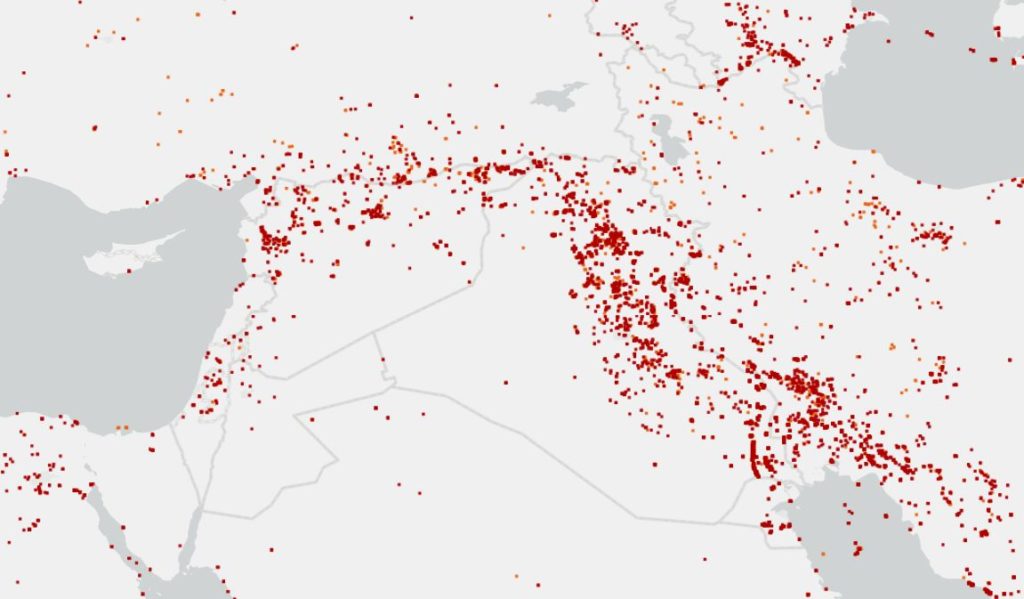
At UFFA we care about statics and maps of global wildfire. Looking at one of these fire maps from NASA or the EU-Science-Hub will let us worry and think that the whole plante is on-fire!
Well, it’s not! According to NASA these maps called “fires and unusual thermal activities”, Having said that, it is quite difficult to distinguish between a “wildfire” and an “unusual thermal activity”. At least the process is difficult on a large scale.
Wildfire vs. Unusual Thermal Activity
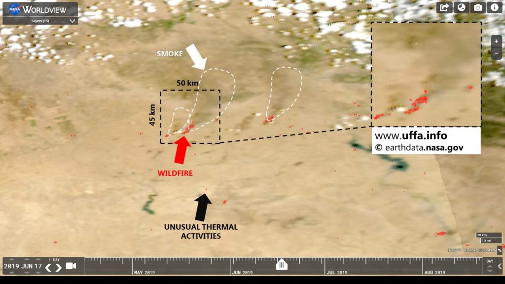
Using the map above – 93 days of fire activities according to NASA in northern Syria -, we were able to distinguish between them. Wildfires were obvious through their density and smoke improvement.
It is fundamental to observe the development of wildfire extendedly (i.e. longer than just one day). Through switching the fire-data-maps of the above-mentioned period backward and forward, we were able to distinguish between a wild fire and small “unusual thermal activity”. On the fire-data-map: wildfires were mostly forming a group or a series of ‘points’, which expands and develops for at least few hours. These points were moving their position regarding the fire propagation. Another important factor is the developed smoke over the wildfire, which can also be seen on the aerial view maps.
Graphic system: a deep issue?
Taking any fire map from the database of NASA or the EU-Science-Hub drives us to believe that HUGE areas are on-fire! On the other hand, taking one particular region for example and zooming from the globe-scale to small-village-scale will show occasionally, that only few square meters are burning! It is worth mentioning that these tiny ‘dots’ on the globe-scale seems to appear as big as Tokyo or New York!
Wildfire IS a problem
The aim of this article is neither to deny the wildfire problem nor to question the credibility of the fire-data-maps. Fire maps are one of the fundamental tools in terms of developing wildfire extinguishing measures. A better understanding of these maps will lead a more efficient wildfire fighting.
We will publish the complete results we found on these maps soon.
We give the opportunity to everyone who wants to participate and create the content with us. Contact us to discover HOW you can join our team.